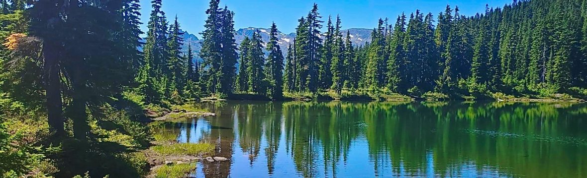
Hiking, Vancouver Island

Day 30: Pub-to-Pub Hike or Bust!

Distance Walked: 9.14 km Walking Time: 2.5 hrs Pubs: Mount Arrowsmith Brewing Company and The Black Goose Inn Route: Easy Richard and I had unanimously agreed that the final day of our #30hikesin30days Challenge should be the Oyster River Pub-to-Pub Hike near Courtney, BC. What a perfect way to walk and celebrate at the same… Continue reading Day 30: Pub-to-Pub Hike or Bust!

Hiking, Vancouver Island

Day 29: Shelly Creek Park and E & N Rail Loop, Parksville

Shelly Creek Park and Rail Loop: 4.25 km Coffee Loop: 4.02 km Total Distance Walked: 8.27 km Total Walking Time: 2 hrs Shelly Creek is a tributary to the Englishman River. It begins on Little Mountain and flows into the river near Parksville's Orange Bridge. Shelly Creek Park is the last healthy riparian section of… Continue reading Day 29: Shelly Creek Park and E & N Rail Loop, Parksville

Hiking, Vancouver Island

Day 28: Stocking Creek Falls, Saltair

Trails: Stocking Creek and Cowichan Valley Access: 11014 Finch Place or 10786 Chemainus Road, Saltair (near Ladysmith) Distance Walked: 8.88 km Walking Time: 2 hr 8 min Difficulty: Both easy and moderate paths are available. What's not to love about trails that meander through a rainforest, give you easy access to a waterfall (that you… Continue reading Day 28: Stocking Creek Falls, Saltair

Hiking, Vancouver Island

Day 27: Fern Road Woods Trail / Qualicum-Parksville Link

Distance Walked: 9.4 km Walking Time: 2 hrs Trail Rating: Easy The Fern Road Woods Trail gives Qualicum Beach residents a scenic, low-traffic, multi-purpose route to travel to the downtown core or to simply use for recreational purposes (it includes a No Through Road). This trail is part of the 13 km Parksville-Qualicum Beach Link… Continue reading Day 27: Fern Road Woods Trail / Qualicum-Parksville Link

Hiking, Vancouver Island

Day 26: Protection Island

Distance Walked: 7.01 km Walking Time: 1 hr, 42 min Trail Rating: Easy History: Protection Island is located in the harbour of Nanaimo, BC. It is home to 350 full-time residents. Locals commonly travel across the island by golf cart, while some transfer their groceries, recycling and garbage from the community dock by wheelbarrow. Many… Continue reading Day 26: Protection Island

Hiking, Vancouver Island

Day 25: Duke Point, Crescent Beach and White Rock Pier

DISTANCES WALKED Duke Point Ferry Terminal: 3 km Duke Point Ferry: 7 km Crescent Beach: 3.75 km White Rock Pier: 5.25 km Combined Distances Walked: 19 km Combined Walking Time: 5 hrs I wasn't sure how I would squeeze in a hike today, let alone 7 km (our minimum daily hiking distance in this series… Continue reading Day 25: Duke Point, Crescent Beach and White Rock Pier

Hiking, Vancouver Island

Day 24: A Tale of Two Trails: Jack Point Park and Morrell Nature Sanctuary, Nanaimo

Trail 1: Jack Point Trail Loop (Duke Point) Distance Walked: 6 km Walking Time: 1 hr, 45 min Trail Rating: Easy Jack Point Park is a fascinating place with much to offer. It is a Geopark, recognized for its geological interest. In particular, the sandstones and mudstones found here display unique erosion features. This park… Continue reading Day 24: A Tale of Two Trails: Jack Point Park and Morrell Nature Sanctuary, Nanaimo

Hiking, Vancouver Island

Day 23: Nymph Falls, Comox Valley

Distance Hiked: 18 km Walking Time: 4 hrs Trail Rating: Easy and Moderate trails are available Location: 4481 Forbidden Plateau Road, Comox-Strathcona History: Nymph Falls resulted from  the creation of a fish ladder on the Puntledge River, completed by the Department of Fisheries and Oceans and BC Hydro, in the early 1950s.In 1992, the Comox… Continue reading Day 23: Nymph Falls, Comox Valley